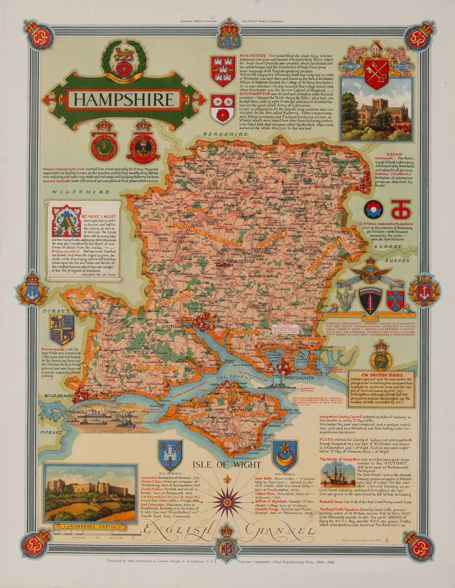
Pictorial map showing Wartime Activities and Land Use in Hampshire
- 1947
- Ernest Clegg (1900-1953)
-
17 x 23 inches ~ (43 x 58 cm)$265
- Linen backed
Linen backing is the industry standard of conservation. Canvas is stretchered and a sheet of acid free barrier paper is laid down. The poster is then pasted to the acid free paper using an acid free paste. This process is fully reversible and gives support to the poster. A border of linen is left around the poster and can be used by a framer to mount the poster so that nothing touches the poster itself.
The price of this poster includes linen backing.
- Add to Cart Add to Wishlist E-Mail Us About This Poster
Interesting illustrated map showing Wartime activities and land use in Hampshire. Created shortly after WWII the map shows locations of Radar Installations, U.S. Forces Stationed in Hampshire, along with historical and agricultural sites in the county.
Printed for the British Travel Association by Charles & Read 1947