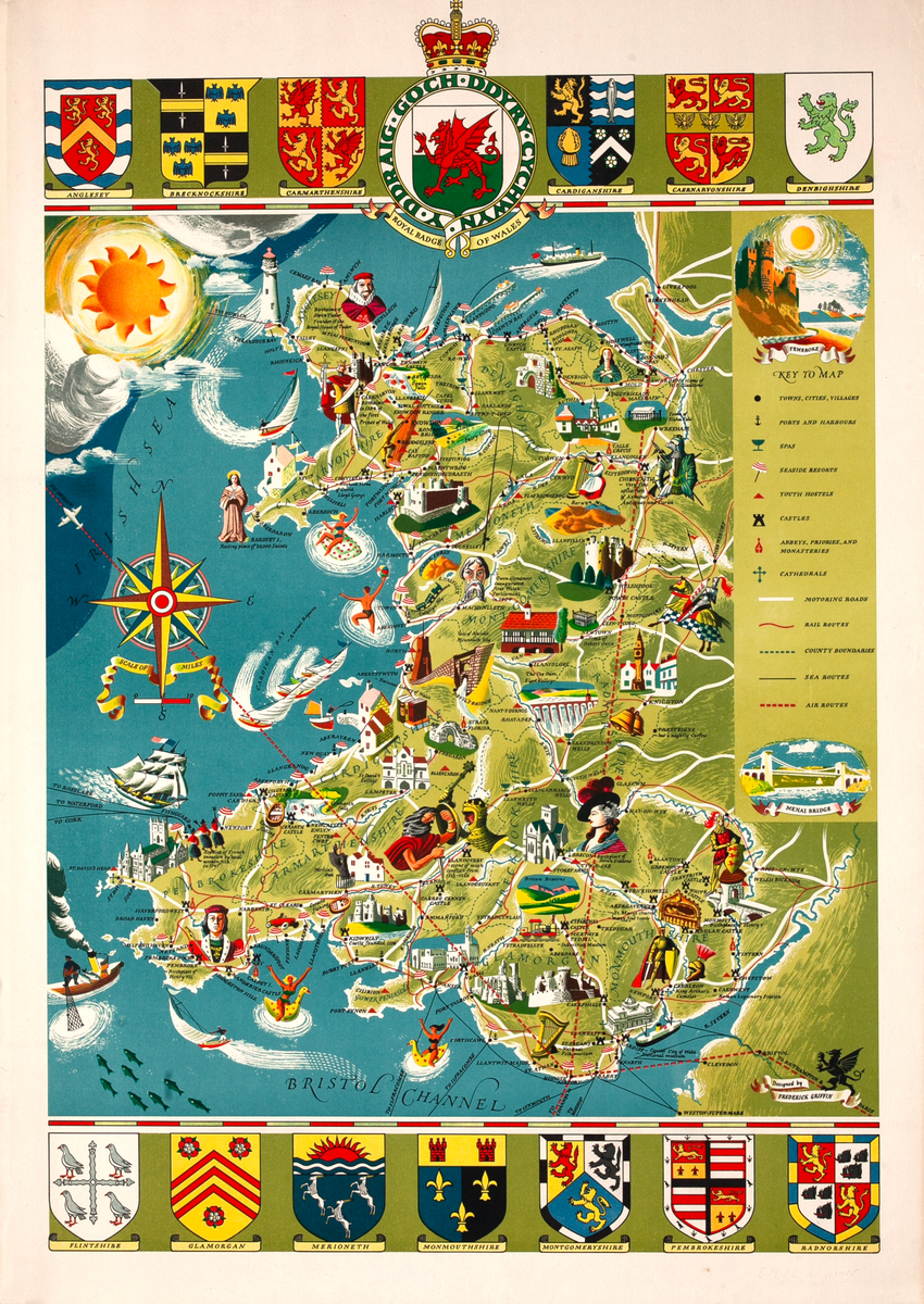
Illustrated Map of Wales Original Travel Poster
- ca 1950s
- Frederick Griffin
-
25 x 36 inches ~ (63 x 91 cm)$210
- Unbacked
This poster is currently unbacked. At check out, you will be given the opportunity to add backing which would cost $145 and take approximately 6-8 weeks.
Linen backing is the industry standard of conservation. Canvas is stretchered and a sheet of acid free barrier paper is laid down. The poster is then pasted to the acid free paper using an acid free paste. This process is fully reversible and gives support to the poster. A border of linen is left around the poster and can be used by a framer to mount the poster so that nothing touches the poster itself. Backing is what we recommend for framing, and for any poster needing restoration.
- Add to Cart Add to Wishlist E-Mail Us About This Poster
Pictoral map of Wales including icons of places of interest, historical figures, tourist attractions, sporting activities, towns, cities, villages, ports, harbours, spas, seaside resorts, youth hostels, castles, religious sites, rail routes, roads, county boundaries sea and air routes. Coats of arms of local Welsh areas surround the illustrated maps.
Published by the British Travel and Holidays Association.
This poster is a variation without added text at bottom.